


Subsurface Solutions Without the Workstation.
OG Welly is a full subsurface toolkit that runs directly in your browser: full development wellbore plotting, built-in structure grids, log correlation, StrataView, type curves and economics. With public Texas data already loaded, you can try all of it before you import a thing.
Gun-Barrel View, in Seconds
Quickly generate gun barrel or sideview plots in seconds - using real surveys, not bottom-hole depths.
Easy Data Imports
Welly is designed to instantly accept standard data imports with little to no cleanup.
Saved Across Sessions
Pick up where you left off, with your data, layer selections and map view stored securely.
Flexible Licensing
Don't get locked into a long term, expensive contract - cancel at any time.
What's in the application
Every feature below is available on the free plan. Paid plans raise the storage, grid and assistant limits.
Texas Well Data
Every permitted well in the state, on the map without importing anything. Operator, lease, field and total depth; drilling permits with spud dates; the RRC well bore record with elevation and datum; FracFocus completion disclosures; and allocated production.
Built-In Grids
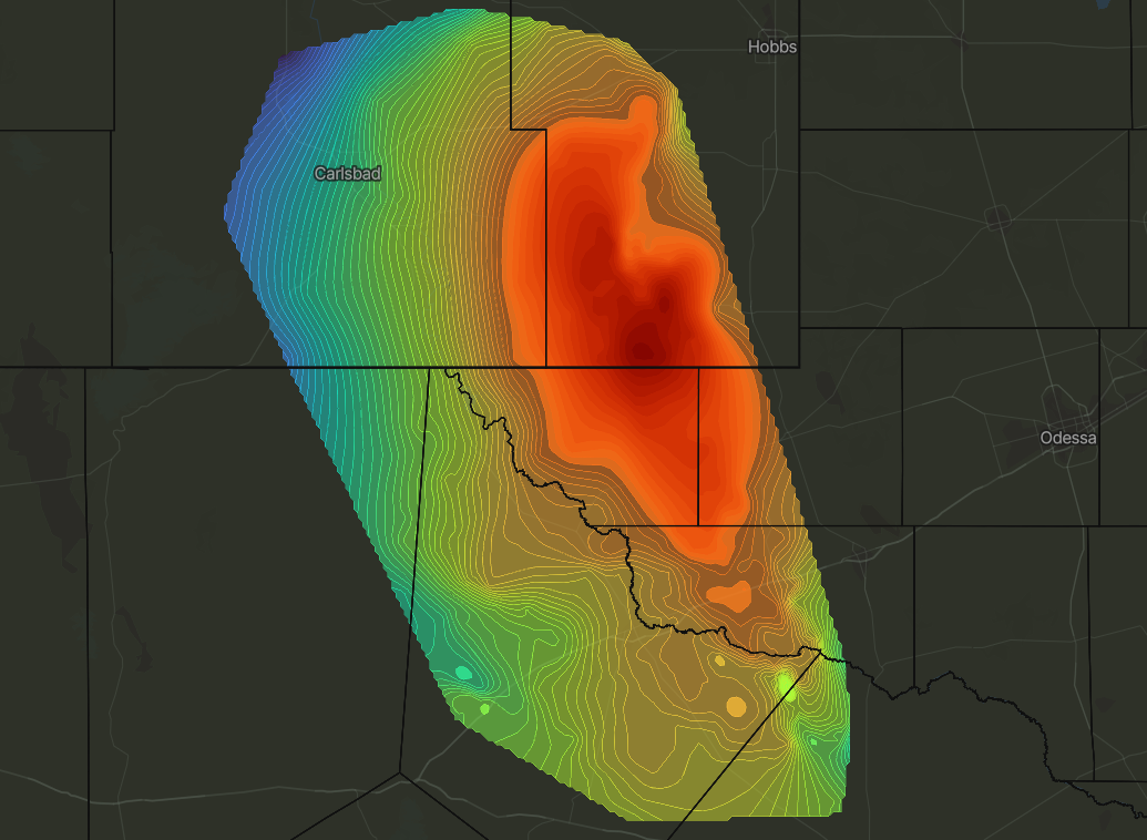
34 interpreted horizons across five basins. Contour them on the map, sample them along a wellbore, or use them as the datum for a cross section or a StrataView run.
Wellbore Plots & Gun Barrels
Plots built from directional surveys rather than surface and bottomhole locations. The gun barrel line rotates through 360° and pans up to 10,000 ft either side of strike. Gridded tops can be drawn over either view.
Cross Sections & Correlation
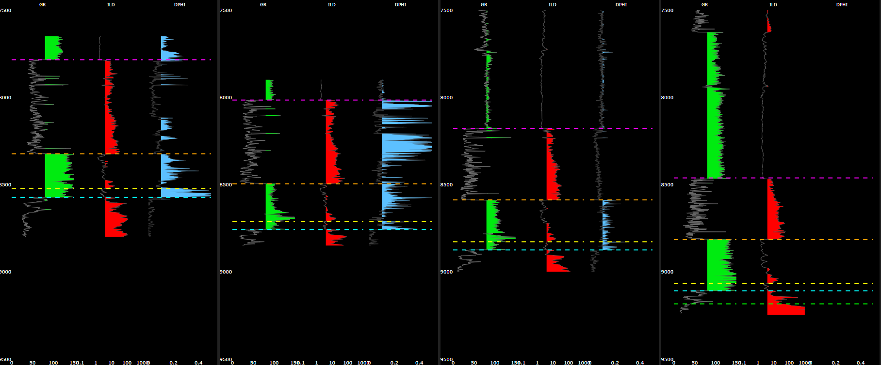
Bulk LAS import. Draw a cross section between logs on the map, pick tops directly on the curves, and set shading, scale and colour per curve. Saved symbologies can be reused across sections.
Stratigraphic Position
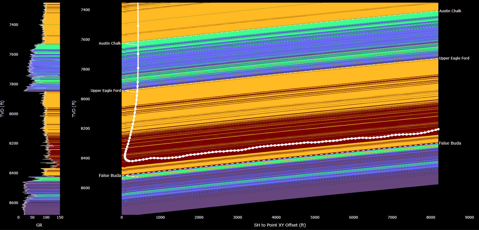
Interpolates well log values along a horizontal wellbore against a gridded formation top. MWD curves colour the survey stations, and a measured depth slider shows where the wellbore sits at any point along the lateral.
Data Questions
Answers questions against the public data and your project: offsets and spacing, completion intensity from FracFocus, production history and decline. It quotes the distance to each well it compares, and can move the map or select wells for you.
Structure grids across five basins
34 horizons covering roughly 41,000 square miles, built from about 38,000 control points. Primary and secondary zones of interest in each basin.
Log values along the lateral
Use grid surfaces and nearby .LAS data to see where a wellbore sits in the section. The MWD curve colours the trajectory beside the type log, and a manual offset ties MWD depth to wireline depth.
Cross sections and top picking
Pick tops, adjust symbology by curve, and interact with individual well log plots. Tops written here go straight into your grids.
AI assistant
Reads the public Texas data and your project. Every figure it reports comes from a query against one of the two.
- Offsets and spacing, measured lateral-to-lateral, with the distance to each well quoted.
- Completion intensity from FracFocus, normalised per foot.
- Production and EUR, including decline behaviour and ranking across a set of wells.
- Map control: it can pan, select wells and annotate what it is describing.
Imports
Standard formats, mapped to your columns at upload. Files are processed in the background, so you can keep working while they load.
- Shapefiles (zip), drawn as vector tiles with attribute-driven symbology.
- Directional surveys, well headers, formation tops and production (csv).
- Well logs and MWD logs (.las), in batches of up to 1,000 files.
- Everything is stored per project, and deletable at any time.
Decline curves and type curves
Arps fitting over a window you set, with qi, di and b editable by hand and an economic limit by rate or by months. Pricing, NRI, LOE and tax inputs produce an NPV. Save forecasts to a group to build a type curve, normalised by a header field such as lateral length.
What the free plan includes
Premium raises storage to 50 GB, unlocks every basin's grids and raises the assistant to 5 MM tokens a day. Cancel at any time.
Questions?
Please reach out to us, and we'll contact you!